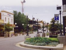
| Corowa facts and figures: |
|
Corowa location map: |
| Population: |
5,600 * |
| Municipality: |
Corowa Shire |
| Municipality population: |
11,000 |
* Data from 2006 ABS Census for urban centre, suburb or locality
|
|
 |
| |
| Corowa transport information: |
|
|
| Location: |
- 277 kms north of Melbourne
- 622 kms south-west of Sydney
|
| Major roads: |
- Corowa - Tocumwal Rd
- Wahgunyah - Wangaratta Rd
|
| Major airports: |
- Sydney (Mascot) (613 kms)
- Melbourne (Tullamarine) (272 kms)
- Geelong VIC (Avalon) (328 kms)
- Albury (61 kms)
|
| Nearby passenger railway stations: |
- Springhurst VIC (26 kms)
- Chiltern VIC (28 kms)
- Wangaratta VIC (42 kms)
- Albury (56 kms)
- Wodonga VIC (58 kms)
|
|
|
|